
 by
by High in the western Himalayas of Uttarakhand, hidden behind jagged snow-draped ridges, lies a high-altitude meadow that feels entirely detached from the rest of the world. The Valley of Flowers is not merely a scenic trekking destination; it is a UNESCO World Heritage site, a sanctuary of rare alpine flora, and one of the most vibrant natural displays on the planet. For a brief window each summer, this remote alpine valley transforms from a frozen white expanse into a mosaic of pinks, purples, blues, and yellows.
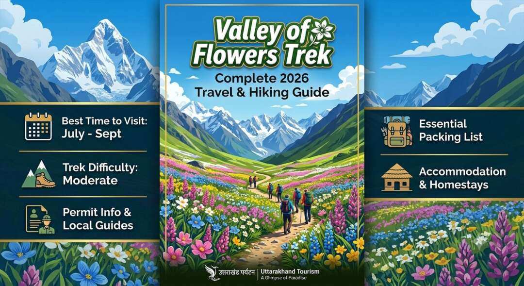
Whether you are an avid high-altitude trekker, a nature enthusiast, a photographer, or a traveler searching for a transformative escape, visiting the Valley of Flowers requires thoughtful planning. The route involves steep ascents, fluctuating mountain weather, and precise timing aligned with the monsoon blossom season.
This guide covers everything you need to know about the Valley of Flowers: its geography, historical discovery, ideal visiting windows, full itinerary planning, environmental considerations, and essential preparation strategies for a successful trek.
What is the Valley of Flowers?
                         [ VALLEY OF FLOWERS ]
                                  |
            +---------------------+---------------------+
            |                                           |
    [ GEOGRAPHY ]                               [ BOTANY ]
  • Altitude: 3,200m - 3,675m                 • 500+ Floral Species
  • Location: Chamoli, Uttarakhand            • Endangered Wildlife
  • Area: 87.5 sq. km                         • Alpine Ecosystem
Simple Explanation
The Valley of Flowers is a national park located in the Chamoli district of Uttarakhand, India. Nestled in the Zanskar Range of the Himalayas, the valley spans roughly 87.5 square kilometers and sits at an elevation ranging between 3,200 meters (10,500 feet) and 3,675 meters (12,057 feet) above sea level.
Unlike conventional mountain valleys that feature dense evergreen forests, the Valley of Flowers is a high-altitude alpine meadow (locally known as a bugyal). It is nourished by the Pushpawati River, which originates from the Tipra Glacier deep within the park. The valley is enclosed by steep mountain walls, protected from harsh environmental degradation, and remains snowbound for over seven months of the year.
Why It Matters in 2026+
In an era characterized by urbanization, climate volatility, and habitat fragmentation, high-altitude biodiversity hotspots like the Valley of Flowers are invaluable natural ecological reserves.
- Ecological Conservation: The park serves as a protected sanctuary for over 500 species of flowering plants, including several medicinal herbs that exist nowhere else on Earth.
- Wildlife Refuge: Beyond its flora, the valley sits within the Nanda Devi Biosphere Reserve, forming a migration corridor and habitat for endangered snow leopards, Himalayan musk deer, Asiatic black bears, and blue sheep (bharal).
- Sustainable Tourism Model: Uttarakhand’s strict management protocols—such as prohibiting overnight stays in the core valley and enforcing zero-plastic zones—serve as an important case study for sustainable ecotourism in sensitive high-altitude ecosystems.
Key Features & Highlights
                  +--------------------------------+
                  |  VALLEY OF FLOWERS HIGHLIGHTS  |
                  +--------------------------------+
                                  |
       +--------------------------+--------------------------+
       |                                                     |
[ FLORAL DIVERSITY ]                                 [ SACRED LANDSCAPES ]
 • Himalayan Blue Poppy                               • Hemkund Sahib (4,329m)
 • Brahma Kamal                                       • Pushpawati River
 • Cobra Lily                                         • Glacial Basins
1. Exceptional Botanical Diversity
The primary draw of the national park is its changing carpet of alpine wild blooms. Because different species bloom at different micro-elevations and times during the monsoon season, the valley changes its primary color palette every few weeks between July and September.
| Plant Species | Common Name | Typical Blooming Period | Notable Feature |
| Meconopsis aculeata | Himalayan Blue Poppy | Mid-July to August | Rare, sky-blue translucent petals |
| Saussurea obvallata | Brahma Kamal | Late August to September | Sacred high-altitude flower; yellow-green bracts |
| Arisaema jacquemontii | Cobra Lily | July | Hooded, snake-like spadix structure |
| Epilobium latifolium | Broad-leaved Willowherb | August | Bright pink patches along riverbanks |
| Potentilla atrosanguinea | Dark Crimson Cinquefoil | July to August | Deep red petals with silver-haired foliage |
2. Dramatic Glacial Landscapes
The valley is bordered by towering Himalayan peaks, including Mount Gauri Parbat (6,708 meters) and Mount Hathi Parbat (6,727 meters). Glacial runoff streams cut across the valley floor, creating dynamic river beds, natural stone bridges, and cascading waterfalls that drop hundreds of feet down sheer granite cliffs.
3. Proximity to Hemkund Sahib
The basecamp for the Valley of Flowers, a small settlement called Ghangaria, also serves as the gateway to Hemkund Sahib. Situated at 4,329 meters (14,200 feet), Hemkund Sahib is the highest revered Sikh shrine in the world, positioned beside a glacial lake surrounded by seven mountain peaks. This geographical pairing allows travelers to combine a botanical trek with a cultural and spiritual journey.
Benefits of Visiting the Valley of Flowers
                       [ VISITOR EXPERIENCES ]
                                  |
      +---------------------------+---------------------------+
      |                           |                           |
[ PHYSICAL HEALTH ]      [ MENTAL WELLBEING ]     [ PHOTOGRAPHIC VALUE ]
 • Endurance Building     • Nature Immersion       • High-Contrast Light
 • Cardiovascular Fitness • Digital Detox          • Unique Macro Subjects
Physical and Health Benefits
Trekking to the Valley of Flowers provides rigorous physical conditioning. The route requires walking over 45 kilometers across a multi-day itinerary, with substantial gain and loss in altitude.
- Cardiovascular Endurance: The gradient between Govindghat, Ghangaria, and the inner valley tests and builds aerobic capacity.
- Lower-Body Conditioning: Navigating stone steps, glacial moraine, and muddy tracks strengthens joints, stabilizing muscles, and core endurance.
- High-Altitude Acclimatization: The progressive height gain offers a managed introduction to high-altitude trekking for individuals looking to prepare for more technical Himalayan expeditions.
Mental Wellbeing & Digital Detox
The core valley has no cellular service, electricity grid connections, or commercial structures. This absolute disconnection forces visitors to engage directly with their environment. The combination of sustained physical exertion, clean mountain air, and natural soundscapes reduces stress markers and improves cognitive focus.
Educational & Photographic Value
For naturalists, botanists, and photographers, the region is a natural classroom. The high light clarity at 3,500 meters, combined with mist, dramatic cloud formations, and vibrant macro floral subjects, offers unique photographic opportunities that lower-elevation routes cannot match.
Geographical & Route Analysis
[ HARIDWAR / RISHIKESH ]
          |
          | (~275 km Drive via NH58)
          v
    [ JOSHIMATH ]
          |
          | (~20 km Drive)
          v
   [ GOVINDGHAT ] ---> (Drive 4 km) ---> [ PULNA ]
                                           |
                                           | (10 km Trek)
                                           v
                                     [ GHANGARIA ]
                                           |
                    +----------------------+----------------------+
                    | (4 km Trek)                                 | (6 km Trek)
                    v                                             v
       [ VALLEY OF FLOWERS ]                             [ HEMKUND SAHIB ]
Regional Connectivity
Reaching the Valley of Flowers requires traversing the middle and upper Himalayas along the Alaknanda River corridor.
- Nearest Airport: Jolly Grant Airport, Dehradun (~295 km from basecamp).
- Nearest Railway Station: Rishikesh or Yog Nagari Rishikesh (~273 km from basecamp).
- Primary Road Access: National Highway 58 (NH58), which connects Haridwar and Rishikesh to Badrinath via Devprayag, Srinagar, Rudraprayag, Karnaprayag, and Joshimath.
The Transit Corridor
The journey is divided into three distinct segments: drive, valley trek to basecamp, and inner sanctuary treks.
- Drive Phase (Rishikesh to Govindghat/Pulna): A 9- to 11-hour mountain drive following the Panch Prayag (the five sacred river confluences of the Alaknanda).
- Basecamp Trek (Pulna to Ghangaria): The road ends at Pulna (a short drive from Govindghat). From Pulna, a 10-kilometer paved trekking trail along the Lakshman Ganga River leads up to Ghangaria (2,980 meters).
- Core Day Treks (From Ghangaria):
- Route A: Ghangaria to Valley of Flowers core area (4 km one way to entry gate; trail extends 3–5 km inside the valley).
- Route B: Ghangaria to Hemkund Sahib (6 km one way, with an elevation gain of over 1,300 meters).
Historical & Ecological Significance
                       [ HISTORICAL TIMELINE ]
                                  |
     +----------------------------+----------------------------+
     |                            |                            |
  [ 1931 ]                     [ 1939 ]                     [ 1982 / 2005 ]
 Frank Smythe               Joan Margaret Legge           National Park &
 Discovers Valley           Botany Research               UNESCO Designation
Discovery by Frank Smythe
While the local inhabitants (Bhotia community) were aware of the valley for centuries—often avoiding it due to folklore that it was the domain of mountain fairies (Yaksha)—the valley was introduced to the modern world in 1931. British mountaineers Frank S. Smythe, Eric Shipton, and R.L. Holdsworth stumbled into the valley while returning from a successful climb of Mount Kamet. Smythe was so captivated by the floral density that he authored the book The Valley of Flowers in 1938, making the region internationally famous.
Joan Margaret Legge’s Legacy
In 1939, Joan Margaret Legge, a botanist from the Royal Botanic Gardens, Kew, arrived to study and catalog the valley’s flora. Tragically, while traversing slippery slopes to collect samples, she slipped and fell to her death. Her sister later erected a memorial stone in the inner valley, which remains an important historical point along the trail today.
UNESCO World Heritage Status
Recognizing its fragile biodiversity, the Indian government declared the region a National Park in 1982. In 2005, UNESCO expanded the existing Nanda Devi National Park inscription to include the Valley of Flowers, designating the combined Nanda Devi and Valley of Flowers National Parks as a World Heritage Site.
Seasonal Comparison: When to Visit
The park is open to visitors for a limited period, typically from June 1st to October 31st. The character of the valley changes significantly across these months.
JUNE                   JULY                  AUGUST               SEPTEMBER              OCTOBER
|----------------------|----------------------|--------------------|----------------------|
 Snow melts             Monsoon begins         Peak blooms          Flowers set seed       Park closes
 Cascading streams      Greenery explodes      Maximum species      Clear blue skies       First snows
| Feature | June | July | August | September | October |
| Primary Attraction | Melting snow, swollen rivers | Early blossoms, lush greenery | Peak floral density & variety | Clear skies, autumn colors | Crisp air, minimal crowds |
| Bloom Level | Low (5–15%) | Moderate (40–70%) | Maximum (80–100%) | Declining (20–40%) | Minimal (<5%) |
| Trail Conditions | Snow patches, wet paths | Muddy, frequent rain | Very wet, potential landslides | Dry, clear, stable | Cold, slippery frost |
| Temperature Range | 10°C to 18°C | 12°C to 20°C | 12°C to 18°C | 7°C to 15°C | 0°C to 10°C |
| Crowd Levels | Moderate | High | Very High | Moderate | Low |
Best Window for Flowers: Late July to Mid-August
If your main goal is to see the maximum concentration and variety of flowers, target the window between July 20 and August 25. During this period, the southwest monsoon brings consistent moisture, causing millions of seeds to germinate and bloom simultaneously.
Best Window for Clear Views: September
If you prefer stable weather, crisp mountain photography, and lower rainfall risks over maximum flower density, early to mid-September is ideal. The monsoon retreats, the skies clear to a deep alpine blue, and the valley shifts into bronze, golden, and red hues.
Step-by-Step Trekking Guide
+-----------------------------------------------------------------------------------+
|                                  6-DAY ITINERARY                                  |
+-----------------------------------------------------------------------------------+
|  DAY 1: Drive Rishikesh to Govindghat / Pulna (275 km)                            |
|  DAY 2: Trek Pulna to Ghangaria (10 km, ~5-6 hrs)                                 |
|  DAY 3: Trek Ghangaria to Valley of Flowers & return (12-14 km, ~7-8 hrs)         |
|  DAY 4: Trek Ghangaria to Hemkund Sahib & return (12 km, steep, ~7-9 hrs)         |
|  DAY 5: Trek Ghangaria to Pulna; drive to Govindghat / Joshimath (10 km trek)     |
|  DAY 6: Drive Joshimath to Rishikesh / Haridwar (275 km)                          |
+-----------------------------------------------------------------------------------+
Day 1: Rishikesh to Govindghat / Pulna
- Distance: ~275 km drive
- Time: 9–11 hours
- Altitude Gain: 340 meters to 1,820 meters
Start your drive early from Rishikesh (by 5:00 AM) to avoid delays along National Highway 58. The road follows the Alaknanda River, passing through Devprayag, Srinagar, Rudraprayag, Karnaprayag, and Nandaprayag. After passing Joshimath, descend toward Govindghat. From Govindghat, a shared taxi route takes you 4 km further to Pulna, where the vehicle road ends. Overnight stay at Govindghat or Pulna.
Day 2: Pulna to Ghangaria
- Distance: 10 km trek
- Time: 5–6 hours
- Altitude Gain: 1,820 meters to 2,980 meters
The trek begins at Pulna along a stone-paved trail running parallel to the roaring Lakshman Ganga River. The first half of the trek features a gradual gradient, passing small tea stalls and cross-river bridges. As you approach the final 3 kilometers, the trail steepens significantly through pine and rhododendron forests.
Ghangaria is a small cluster of seasonal hotels, helipads, and restaurants. Check into your accommodation, rest, and hydrate.
Day 3: Ghangaria to Valley of Flowers (Core Day)
- Distance: 12 to 14 km round trip
- Time: 7–8 hours
- Altitude Gain: 2,980 meters to ~3,500 meters (and return)
1.Forest Checkpost Registration:Ghangaria Village Outskirts.
Report to the Forest Department checkpost early (opens at 6:30 AM). Pay the mandatory entry fee and obtain your park permit.
2.Crossing the Lakshman Ganga Bridge:0.5 km from Checkpost.
Cross the narrow iron bridge over the rushing river, after which the trail immediately veers left and begins a steady, rocky climb through dense forest.
3.Crossing Pushpawati River Bridge:2 km from Checkpost.
Cross a wooden bridge over the gorge where the Pushpawati River cascades. This marks the official geographic entry into the lower mouth of the valley.
4.Exploration of the Core Valley:2.5 km to 7 km inside.
The trail flattens into an expansive open meadow. Follow the defined path toward Joan Margaret Legge’s memorial stone or further toward the Tipra Glacier viewpoint. Ensure you begin your return journey by 1:30 PM to exit the park before dusk.
Day 4: Ghangaria to Hemkund Sahib and Return
- Distance: 12 km round trip
- Time: 7–9 hours
- Altitude Gain: 2,980 meters to 4,329 meters (and return)
This is a physically demanding day. The trail to Hemkund Sahib climbs over 1,300 vertical meters in just 6 kilometers. The path consists of steep zig-zag stone steps. As you gain altitude, the tree line recedes, and the air thins noticeably.
Upon reaching the summit, you will find the glacial Hemkund Lake and the Gurudwara Hemkund Sahib. Take time to rest, visit the warm community kitchen (langar), and observe the rare Brahma Kamal flowers growing along the surrounding rocky slopes. Descend carefully back to Ghangaria before late afternoon fog sets in.
Day 5: Ghangaria to Pulna; Drive to Joshimath
- Distance: 10 km trek downhill + 20 km drive
- Time: 4 hours trek + 1 hour drive
Descend from Ghangaria along the same 10-kilometer route back to Pulna. The downhill trek is faster but places significant pressure on knees and toes; trekking poles are strongly recommended. From Pulna, take a vehicle to Govindghat and continue to Joshimath for an evening of rest and hot showers.
Day 6: Joshimath to Rishikesh / Dehradun
- Distance: ~275 km drive
- Time: 9–10 hours
Depart Joshimath early in the morning for the long drive down the mountain corridor back to Rishikesh or Dehradun, marking the conclusion of the trek.
Expert Practical & Safety Tips
                     +----------------------------------+
                     |    CRITICAL SAFETY PROTOCOLS     |
                     +----------------------------------+
                                      |
         +----------------------------+----------------------------+
         |                            |                            |
  [ MOUNTAIN SAFETY ]          [ LOGISTICAL CARE ]          [ GEAR & CLOTHING ]
   • AMS Management             • Buffer Days                • Waterproof Layering
   • Hydration (>3L/day)        • Cash Reserves              • Trekking Poles
   • Early Starts (6 AM)        • Buffer Time for Roads      • Ankle-Support Boots
- Build Buffer Days into Your Schedule: Monsoon traveling in Uttarakhand carries the risk of temporary road blockages due to landslides along NH58. Always add at least one extra buffer day to your overall itinerary before booking onward flights or train tickets from Dehradun/Rishikesh.
- Manage Altitude Sickness (AMS): Ghangaria sits at nearly 3,000 meters, and Hemkund Sahib exceeds 4,300 meters. Drink 3 to 4 liters of water daily, avoid alcohol and sleeping pills, and monitor yourself for signs of Acute Mountain Sickness (headaches, nausea, dizziness). Ascend Hemkund Sahib at a steady, slow pace.
- Carry Sufficient Cash: There are no functioning ATMs past Joshimath or Govindghat. Ensure you carry enough cash to pay for food, accommodation, porter services, and forest permits at Ghangaria.
- Start Days Early: Weather in high mountain valleys follows a predictable daily cycle during the monsoon: clear or overcast mornings, followed by rain or heavy mist in the afternoon. Starting your daily treks by 6:00 AM ensures you cover maximum ground during the safest, clearest conditions.
- Use Proper Footwear: The trails inside the Valley of Flowers and on the route up to Ghangaria are made of uneven, wet stone paving. High-top trekking boots with good ankle support and deep lugs are essential to prevent slips and sprains.
Common Mistakes to Avoid
- Attempting to Camp Inside the Core Valley: Camping inside the Valley of Flowers National Park is strictly illegal. The Forest Department enforces this rule to protect fragile flora and wildlife. All visitors must enter after 6:00 AM and exit the park boundaries by 5:00 PM every day.
- Underestimating Waterproof Gear Needs: Standard umbrellas or light windbreakers are insufficient during peak monsoon trekking. Invest in a heavy-duty waterproof poncho or a high-rating (10,000 mm+) waterproof hard-shell jacket along with waterproof pants and a rain cover for your backpack.
- Plucking Flowers or Leaving Trail Paths: The valley’s ecosystem is extremely fragile. Plucking plants, collecting seeds, or stepping off established paths crushes micro-vegetation and carries severe fines from forest rangers.
- Skipping Trekking Poles: The descent from Hemkund Sahib (1,300m drop) and Ghangaria to Pulna (1,160m drop) subjects knees to heavy impact. Using two adjustable trekking poles significantly reduces joint impact and improves balance on wet stones.
Packing Checklist
To ensure a safe and comfortable trek, pack light but prioritize functional weather protection and warmth.
                      +--------------------------------+
                      |       PACKING ESSENTIALS       |
                      +--------------------------------+
                                      |
      +-------------------------------+-------------------------------+
      |                               |                               |
[ CLOTHING LAYERS ]           [ GEAR & FOOTWEAR ]           [ MEDICAL & PERSONAL ]
 • Synthetic Baselayers        • Waterproof Boots            • AMS Medication
 • Fleece / Down Outer layer   • 20-30L Daypack + Cover      • Rehydration Salts
 • Waterproof Poncho/Jacket    • Dual Trekking Poles         • High-SPF Sunscreen
- Footwear: Broken-in waterproof trekking boots, 3–4 pairs of synthetic/wool hiking socks, and lightweight sandals or slip-ons for evening use at Ghangaria.
- Clothing:
- 2–3 moisture-wicking synthetic base layer t-shirts (avoid cotton).
- 2 durable trekking trousers.
- 1 insulating fleece layer or lightweight down jacket for cold evenings in Ghangaria.
- 1 set of heavy-duty rain gear (jacket + pants or an alpine poncho).
- Gear:
- A 20 to 30-liter daypack with rain cover for daily visits to the Valley and Hemkund Sahib.
- Pair of adjustable trekking poles.
- Personal water bottle or hydration bladder (minimum 2-liter capacity).
- LED Headlamp with spare batteries.
- Medical & Toiletries:
- Personal medical kit containing band-aids, blister pads, antiseptic cream, pain relievers, anti-diarrheal medication, and Diamox (after consulting your physician).
- High-SPF sunscreen, lip balm with UV protection, and insect repellent.
- Quick-dry microfiber towel and biodegradable wet wipes.
Environmental Regulations & Responsible Tourism
As a designated World Heritage Site, the Valley of Flowers operates under strict environmental conservation regulations managed by the Uttarakhand Forest Department.
                  +--------------------------------+
                  |  RESPONSIBLE TRAVEL PROTOCOLS  |
                  +--------------------------------+
                                  |
     +----------------------------+----------------------------+
     |                            |                            |
[ LEAVE NO TRACE ]             [ PERMIT SYSTEM ]            [ ECO-PAYMENTS ]
 • Carry out all waste          • Single-entry permits       • Support local porters
 • Zero plastic dumping         • Strict daily cutoff        • Use designated tracks
- Zero-Waste Protocol: Visitors must carry all personal trash (snack wrappers, plastic bottles, tissues) back out of the valley to Ghangaria, where waste collection points are maintained.
- Permit Requirements: Foreign and Indian nationals must present government-issued photo identification at the Ghangaria forest checkpost to purchase entry permits. Permits are valid for three consecutive days from the date of issue.
- Noise and Wildlife Etiquette: Playing loud music on portable speakers, shouting, or attempting to approach wildlife is prohibited. Silence helps preserve the natural atmosphere and increases your chances of spotting native birds and animals along the trail edges.
Why Choose The Koru Ville?
The Koru Ville offers more than just residential plots—it provides an opportunity to own property in a peaceful destination surrounded by nature. Located near the tourism corridor of Jim Corbett National Park and the scenic Tumariya Dam, the township is ideal for buyers seeking long-term appreciation, a second home, or a tranquil lifestyle.
With gated security, planned infrastructure, and the flexibility to choose between residential plots and cottages, The Koru Ville is designed to meet the needs of both end-users and investors looking to benefit from the continued growth of Uttarakhand’s tourism-driven real estate market.
Frequently Asked Questions
What is the best month to visit the Valley of Flowers?
Late July to mid-August is the best time to visit the Valley of Flowers for peak floral density and variety. If you prefer clear skies, stable mountain weather, and fewer crowds over maximum flowers, early September is ideal.
How difficult is the Valley of Flowers trek?
The trek is rated as moderate. While it does not require technical mountaineering skills or previous climbing experience, it demands good physical fitness to handle 10 to 14 kilometers of walking daily on steep, paved stone trails at altitudes between 1,800 and 4,329 meters.
Can you stay overnight inside the Valley of Flowers?
No. Overnight stays or camping within the national park boundaries are strictly prohibited to protect the natural habitat. All visitors must exit the valley and return to basecamp at Ghangaria before dusk every day.
How do I reach the Valley of Flowers from Delhi?
Take a train or flight from Delhi to Haridwar or Dehradun. From Rishikesh, drive along National Highway 58 to Govindghat or Pulna (approx. 275 km / 10 hours). From Pulna, trek 10 km to the basecamp at Ghangaria.
Is the Valley of Flowers safe for solo travelers and seniors?
Yes, the route is well-traveled, clearly marked, and supported by local tea stalls, mule porters, and palanquin (kandi/palki) services along the main trail to Ghangaria and Hemkund Sahib. However, seniors should undergo medical checks prior to the trip due to the high altitude.

Join The Discussion